
Chemin de Barfleur
The Cherbourg and Barfleur routes are known as "Chemins de Cherbourg et de Barfleur".Chemins aux Anglais"They were used in the Middle Ages by the English on their way to Mont-Saint-Michel, often continuing on to Santiago de Compostela.
The "Way of the Interior" starts in Barfleur, the main hub of Anglo-Norman trade during the ducal era, then stops in Montebourg, a town under the protection of Saint James and a major trading centre, famous for its fairs.
After a stop at Carentan, the gateway to the Cotentin peninsula, which protected the region from land and sea incursions, the route crosses the marshes to head towards Périers and take the ancient Roman road down to Coutances, an ancient Gallo-Roman town and later episcopal see, and also the centre of an important Marian pilgrimage (exceptional 13th-century cathedral, a masterpiece of Norman Gothic).
The route then passes through Hocquigny, the site of the Saint-Maur hospital that took in "the poor pilgrims", then skims past the Premonstratensian abbey of La Lucerne, before winding through the countryside towards Genêts, the starting point for the crossing to Mont-Saint-Michel.
THE STAGES![]() Barfleur / Montebourg (39 km)
Barfleur / Montebourg (39 km)![]() Montebourg / Carentan (33 km)
Montebourg / Carentan (33 km)![]() Carentan / Périers (24 km)
Carentan / Périers (24 km)![]() Périers / Coutances (20 km)
Périers / Coutances (20 km)![]() Coutances / Cérences (23 km)
Coutances / Cérences (23 km)![]() Cérences / La Haye-Pesnel (23 km)
Cérences / La Haye-Pesnel (23 km)![]() La Haye-Pesnel / Saint-Jean-le-Thomas (23 km)
La Haye-Pesnel / Saint-Jean-le-Thomas (23 km)![]() Saint-Jean-le-Thomas / Mont-Saint-Michel (17.5 km, including crossing)
Saint-Jean-le-Thomas / Mont-Saint-Michel (17.5 km, including crossing)
Total: 202 km - 9 stages
This Path is a itinerary exclusively on footPart of the route follows the GRR 223, or "coastal footpath", and anything other than walking is strictly prohibited (bicycles, scooters, etc.). Apart from the obvious safety issues, this is about respect for the natural environment and its fragile eco-system, which is a collective asset.
This route is described in the guide published by the Association: Pilgrim's Itinerary - The English Way - From Barfleur and Cherbourg to Mont-Saint-Michel 14 € (+ postage)
To purchase this guide from the Association, visit the shop
THE DIFFICULTIES![]() The first two stages of the guide are too long, so everyone can divide them into three days to spread out the mileage more evenly. There is no shortage of accommodation and places to visit.
The first two stages of the guide are too long, so everyone can divide them into three days to spread out the mileage more evenly. There is no shortage of accommodation and places to visit.![]() Some road crossings are dangerous, so take extra care!
Some road crossings are dangerous, so take extra care!![]() Accommodation capacity varies on this route, with few beds available in various sectors. It is therefore absolutely essential to book for each stage!
Accommodation capacity varies on this route, with few beds available in various sectors. It is therefore absolutely essential to book for each stage!
Special features:
![]() You can reach the Chemin de l'intérieur from Cherbourg by taking the 'Cherbourg / Montebourg' option (34 km), which is described in the guide.
You can reach the Chemin de l'intérieur from Cherbourg by taking the 'Cherbourg / Montebourg' option (34 km), which is described in the guide.![]() The last stage, between Saint-Jean-le-Thomas and Mont-Saint-Michel, is shared with the Chemin de Cherbourg.
The last stage, between Saint-Jean-le-Thomas and Mont-Saint-Michel, is shared with the Chemin de Cherbourg.
THE AREAS WE PASS THROUGH AND THEIR LANDSCAPES
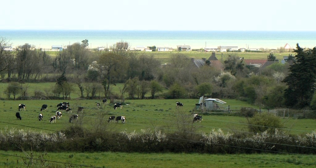
Between land and sea, you'll be seduced by the first stage, which follows the coast to discover the charming port of Barfleur, the harbour of Saint-Vaast-la-Hougue, the island of Tatihou and its rich history, and the "cul de Loup" cove, before entering the countryside to reach Montebourg. The route then crosses the Carentan marshes and joins the Roman road to Périers, before entering the coutançais bocage. For the final leg, it returns to the coast and climbs the cliffs to reveal "the most beautiful kilometre in France" before crossing the Bay from Genêts. Undulating between land and water, this route will take you from one coast to the other, through the exceptional and varied landscapes of the Manche department.
NOT TO BE MISSED![]() BarfleurThe starting point of the Chemins du Mont, its port and the church of Saint-Nicolas
BarfleurThe starting point of the Chemins du Mont, its port and the church of Saint-Nicolas![]() Réville, the church overlooking the cove
Réville, the church overlooking the cove![]() Tatihou Islandits maritime museum, Vauban tower and fortifications (UNESCO World Heritage Site)
Tatihou Islandits maritime museum, Vauban tower and fortifications (UNESCO World Heritage Site)![]() Saint-Vaast-la-Hougueits port, its Romanesque chapel of ND des pécheurs (Our Lady of the Fishermen)
Saint-Vaast-la-Hougueits port, its Romanesque chapel of ND des pécheurs (Our Lady of the Fishermen)![]() Quettehou and the marine graffiti of theSaint-Vigor church
Quettehou and the marine graffiti of theSaint-Vigor church![]() Lestre and its Saint-Michel chapel
Lestre and its Saint-Michel chapel![]() Montebourgits abbey and parish church dedicated to Saint James
Montebourgits abbey and parish church dedicated to Saint James![]() Sainte- Mère-Eglise and its church have been celebrating since 6 June
Sainte- Mère-Eglise and its church have been celebrating since 6 June![]() Sainte-Marie-du-Mont and Utah Beach
Sainte-Marie-du-Mont and Utah Beach![]() Carentan and the church of Notre-Dame, whose south transept gable is topped by a statue of Saint Michael
Carentan and the church of Notre-Dame, whose south transept gable is topped by a statue of Saint Michael![]() Périers
Périers![]() Monthuchon
Monthuchon![]() Saint-Sauveur-Lendelin
Saint-Sauveur-Lendelin![]() Coutancesa stage town on the Chemins du Mont and its famous 13th-century cathedral reviewed in Roots and wings
Coutancesa stage town on the Chemins du Mont and its famous 13th-century cathedral reviewed in Roots and wings![]() Cérences, its Notre-Dame church
Cérences, its Notre-Dame church![]() The Premonstratensian abbey of Saint-Trinité in La Lucerne
The Premonstratensian abbey of Saint-Trinité in La Lucerne![]() Carollesits natural coastline with cliffs, the Lude valley, the Vauban hut from which you can see Mont... and the church of Saint-Vigor and its stained glass window of Saint Michel designed by the artist Jacques Simon.
Carollesits natural coastline with cliffs, the Lude valley, the Vauban hut from which you can see Mont... and the church of Saint-Vigor and its stained glass window of Saint Michel designed by the artist Jacques Simon.![]() Saint-Jean-le-Thomas and its churchwhich houses the remains of a group of Romanesque wall paintings that are unique in the region
Saint-Jean-le-Thomas and its churchwhich houses the remains of a group of Romanesque wall paintings that are unique in the region![]() Genets
Genets
GPX FILES, STEP BY STEP, TO DOWNLOAD FOR GPS
These routes are given for guidance only and are not as accurate as the topographical texts accompanied by the 1:50,000 maps in the guide published by the Association.
VARY THE PLEASURES!![]() Riders will have to change their route at many points, particularly on the coastal sections of the customs trail (GR 223).
Riders will have to change their route at many points, particularly on the coastal sections of the customs trail (GR 223).
![]() The Manche department is now offering "La Route des Abbayes à Cheval". This is a 155km equestrian trail between Cerisy-la-Forêt Abbey and Genêts, specially designed for horse riders, with as few tarmac sections as possible:
The Manche department is now offering "La Route des Abbayes à Cheval". This is a 155km equestrian trail between Cerisy-la-Forêt Abbey and Genêts, specially designed for horse riders, with as few tarmac sections as possible: